Skip to content
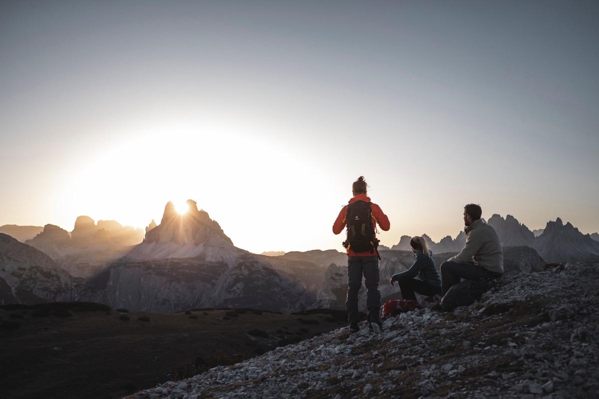
Backlit hikers at sunset over the Dolomites

Hiking and mountaineering in Sexten

From our hiking hotel in Sexten, you head into the Fischleintal valley and up to the huts around the Three Peaks. If you are sure-footed, the via ferratas of the Sexten Dolomites await.

The hotel has its own hiking guide

On the guided hikes in our weekly programme, you set off with a hiking guide, meeting right at the hotel. The guide shows you new paths and lovely spots in the land of the Three Peaks, and you do not have to think about the route.

If you would rather head out on your own, you can borrow a rucksack, hiking poles, a rain poncho, a compass and hiking maps from us free of charge. That way, none of it needs to take up room in your suitcase.

Guided
with a hiking guide
Home
right at the hotel
Equipment hire
free of charge
Weekly programme
included

Six destinations to start with

These six hikes to huts and summits around Sexten are a good place to start.

DestinationHomeWalking time
Drei Zinnen Hut (Rifugio Locatelli), 2,405 mTalschlusshütte, through the Altensteintal valleyapprox. 2½ hrs
Zsigmondy HutTalschlusshütteapprox. 2 hrs
Innergsell, 2,065 mSexten2½ to 3 hrs
AußergsellSexten, descent through the Innerfeldtal valley2½ to 3 hrs
Mount HelmSextenapprox. 4 hrs
Burgstall, 2,168 mRotwandwiesen meadows¾ hr
The south faces of the Three Peaks (Drei Zinnen) at dusk

Hiking in Sexten

When hiking in Sexten, you walk through the Fischleintal valley and across green alpine meadows between high rock faces, or you climb all the way up to a summit. Our Hotel St. Veit is a good starting point for this, for a leisurely valley walk just as for a high-altitude trail or a demanding circular tour.

With children, the themed trails near our hotel are well worth it, as the little ones learn about geology, plants and animals through play. Leisure hikers go to the alpine pastures all around, mountaineers to the next summit. If you head out on your own, we are happy to give you a few tips. The Dolomites are our home.

All hikes with starting point and character

We have put together eleven hikes for you here, from a leisurely forest path to a summit at over 2,500 m.

HikeStarting pointCharacterGood to know
Drei Zinnen Hut (Rifugio Locatelli), 2,405 mTalschlusshütteHut hike through the Altensteintal valleyThe trail passes the Bödenseen lakes
Circuit of the Three Peaks (Drei Zinnen)Rifugio AuronzoCircular tourVia Rifugio Lavaredo, the Paternsattel saddle and Lange Alm
Zsigmondy HutTalschlusshütteAscent between rock faces to a high plateauThe hut stands at the foot of the Zwölferkofel
Knieberg, 2,503 mKreuzbergpassEasy summitVia the Alpe-Nemes-Hütte hut and the Kniebergsattel saddle
Innergsell, 2,065 mSextenSteep but shady ascentReturn via the Ramischköfel into the Fischleintal valley
AußergsellSextenEasy, solitary summitDescent into the Innerfeldtal valley and back to the hotel
Mount HelmSextenAscent of the panoramic mountainAlso accessible by cable car
From the Rotwandwiesen meadows to the KreuzbergpassRotwandwiesen meadows, ascent by cable carEasy, on old wartime pathsWaymarked trail no. 15
From Moos to the Rotwandwiesen meadowsSexten/MoosLeisurely, on moderately steep forest trailsCan be extended to the Burgstall or the Rotwandköpfe
Burgstall, 2,168 mRotwandwiesen meadowsDemandingExtension of the tour from Moos
RotwandköpfeRotwandwiesen meadowsSummit destination with all-round views2½ hrs from the Rotwandwiesen meadows

Hut hikes from the Talschlusshütte in the Fischleintal valley

From the Talschlusshütte in the Fischleintal valley, you climb through the unspoilt Altensteintal valley to the Drei Zinnen Hut (Rifugio Locatelli). The trail runs along the foot of the north face of the Einserkofel, first to the Bödenseen lakes and then on to the hut. The mountains of the Sexten Dolomites are before you the whole way.

The path to the Zsigmondy Hut also starts at the Talschlusshütte. Between high rock faces you climb up to a high plateau, where the hut stands at the foot of the Zwölferkofel. At the top there are far-reaching views and the specialities of the hut kitchen.

The circuit of the Three Peaks (Drei Zinnen) from Rifugio Auronzo

The circuit around the Three Peaks (Drei Zinnen), the best-known rock formation in the Dolomites, is a highlight of a hiking holiday in Sexten. It starts and finishes at Rifugio Auronzo. Via Rifugio Lavaredo you hike to the Paternsattel saddle and continue at the foot of the Paternkofel until the trail forks. There, follow the signpost to the Drei Zinnen Hut (Rifugio Locatelli) and then the “Lange Alm” waymark until you are back at the starting point.

Knieberg, Innergsell, Außergsell and Mount Helm

The Knieberg at 2,503 m is an easy summit with a beautiful panorama. From the Kreuzbergpass you hike first to the Alpe-Nemes-Hütte hut and then east along a gently rising forest road up to the Kniebergsattel saddle. There you turn left, and a zigzag path takes you over the south-east ridge to the summit.

You climb the Innergsell straight from Sexten on a steep but shady path, coming across traces of the First World War again and again. At the top, the Dolomites with the Sexten Sundial lie before you. The way back leads over the Ramischköfel, down into the gully of the Bärisbach stream and on into the Fischleintal valley.

Looking above all for peace and quiet? Then we recommend the Außergsell. The trail leads through flowering alpine meadows and past rustic huts to an easy, secluded summit. On the descent you hike into the Innerfeldtal valley and from there back to the door of our hotel in Sexten.

On foot from Sexten, you hike up Mount Helm, the viewing mountain, in around 4 hours. At the top you look straight at the Sexten Sundial. With children, you can ride up comfortably on the cable car and explore Olperl’s Mountain World together.

Hikes from the Rotwandwiesen meadows

The hike from the Rotwandwiesen meadows to the Kreuzbergpass is easy and follows old wartime paths. You take the cable car up to the Rotwandwiesen. From there, the well-marked trail no. 15 leads through meadows and forests and beneath bizarre rock formations to the pass. On the way back you walk first to the Signaue and then along the Sexten circular trail to the starting point.

You hike at a leisurely pace from Sexten/Moos on moderately steep forest trails to the Rotwandwiesen meadows. If you still feel like more, carry on upwards: in ¾ of an hour on a demanding path to the Burgstall or in 2½ hours to the Rotwandköpfe, with all-round views of the Dolomites.

Four via ferratas and what they require

Around the Three Peaks, a great deal of mountaineering history has been written in the Sexten Dolomites, and people still climb here today. The table shows where the four via ferratas start and what they ask of you.

Via ferrataStarting pointRequirements
RotwandspitzeRotwandwiesen meadows, ascent by cable carEasy via ferrata, but requires sure-footedness, a head for heights and mountain experience
AlpiniwegTalschlusshütteA head for heights and a via ferrata set are mandatory
PaternkofelTalschlusshütte in the Fischleintal valleyA head for heights, sure-footedness, via ferrata experience
Monte PianaCar park at Hotel Drei-Zinnen-BlickChoice between a moderately difficult via ferrata and an easier path

Via ferrata to the Rotwandspitze

The route up Sexten’s local mountain begins with a cable car ride up to the Rotwandwiesen meadows. Behind the Rudihütte hut, waymark 100 leads up through the forest and around the Rotwandköpfe. At the fork on their western side, keep left and climb over steep slopes to a grassy ridge that opens up the view of the north face of the Elfer.

Now you switch to the eastern side of the Rotwandköpfe and climb over scree and a steep step up to the north ridge of the Rotwand. At a small notch, path 15 b from the Burgstall joins the route. Then comes the most difficult passage of the ascent: a steep 20 m section with gullies and rock steps, secured by a fixed rope. Across terraces and a rock ledge, you finally reach the summit cross of the Rotwandspitze, with a view of the Sexten Dolomites.

Allow 3 to 3½ hours for the ascent from the Rotwandwiesen meadows. The way down follows the same route at first as far as the junction with path 15 b, then leads over scree to the Burgstall and on to the Rotwandwiesen meadows. Allow 2½ hours for this from the summit, after which the cable car takes you back down to the valley.

For the ascent, we recommend the more scenic variant via the Rotwandköpfe, also waymarked no. 100. Apart from an iron ladder about 8 m high, there are no difficult sections, and further up you rejoin the main ascent.

Alpiniweg: via ferrata from the First World War

When mountaineering in Sexten, you keep walking on paths from the First World War. Italian mountain troops built the Alpiniweg at that time, and today it leads you through vertical rock faces and deep gorges. From the Talschlusshütte, follow trail 103 on the right to the Zsigmondy Hut. Beyond the hut, trail 101/103 drops a little and makes a long traverse across the large scree slopes beneath the north face of the Zwölfer, heading all the while for the Giralba-Joch pass.

Just below the pass, Alpiniweg no. 101 turns off to the left. The waymarks guide you through the broad saddle between the Hochleist and the Hochbrunnerschneide onto a rock ledge that ends in a deep, gorge-like cleft. After the gorge the terrain becomes easier, but soon the route skirts a steep, rope-secured rock face into the “Äußeres Loch” cirque south of the Elfer.

You walk round the cirque and climb the somewhat tamer western flank of the Elfer to the Elferscharte notch, the finest viewpoint of the whole tour. Down into the Fischleintal valley, the steep, scree-covered but more scenic trail 124 leads to the Dolomitenhof; alternatively, trail 122 goes directly to the Talschlusshütte.

Would you like to save yourself around 450 m of descent? Then take trails 100 or 124 to the Rotwandwiesen meadows and ride the cable car down into the valley. The tour can also be done in the opposite direction, by the way.

For experienced via ferrata climbers, the route goes on from the Elferscharte notch: the second part of the Alpiniweg leads along a narrow, very exposed rock ledge to the Sentinellascharte notch. From there you descend into the Fischleintal valley or to the Rotwandwiesen meadows.


Through the wartime tunnel up the Paternkofel

South-east of the Drei Zinnen Hut (Rifugio Locatelli) stands the Paternkofel with its long outlying ridges. The summit became known through the mountain war of 1915 to 1917. Since Alpini soldiers restored the old wartime paths and tunnels, it has been a challenging destination for experienced via ferrata climbers.

As far as the Drei Zinnen Hut (Rifugio Locatelli), you follow the hut trail from the Fischleintal valley: from the Talschlusshütte, you climb trail 102 up through the Altensteintal valley. From the hut, faint tracks lead beneath the “Frankfurter Würstl”, a popular practice climbing pinnacle, to the tunnel entrance. You then climb up inside the mountain and look out from the rock onto the panorama of the Sexten Dolomites.

Shortly after the tunnel exit, a steep, rope-secured passage awaits, after which a gully of fine gravel leads up to the Gamsscharte notch. Footholds and steel cables help you through another gully, and over a short, rising ledge and faint tracks across the scree you finally reach the summit with its cross and the Innerkofler memorial plaque.

Monte Piana, a panoramic mountain with wartime history

Monte Piana is a famous viewpoint. You will still find many structural remains and tunnels from the First World War there. From the car park at Hotel Drei-Zinnen-Blick, you hike first through the Höhlensteintal valley, then the Pionierweg trail climbs steeply to a disused military cemetery. Shortly afterwards you choose between a moderately difficult via ferrata on the left and an easier path on the right.

Once at the top, you have the Three Peaks (Drei Zinnen) and Monte Cristallo before you. Past old trenches and military positions you hike south as far as the Carducci pyramid, and the Touristensteig path takes you down to Schluderbach and back to the starting point.

From the south summit, you can descend to the nearby Rifugio Bosi at 2,205 m in ¾ of an hour. If you prefer an easier option, a jeep taxi runs from Lake Misurina to the hut.

When may we welcome you?

We, the Karadar family, and our team will get back to you personally.

Book online

The Booking Südtirol booking form is loading.